Difference between revisions of "Modez"
From SpenchWiki
(→Summary: Mpre AvMap pix) |
|||
| (8 intermediate revisions by the same user not shown) | |||
| Line 1: | Line 1: | ||
== Summary == | == Summary == | ||
| − | + | '''Modez/Aviation Mapper is now running live - [http://maps.spench.net/aviation/ please try the web app]!''' | |
| − | [ | + | The full write-up with: |
| + | * screenshots | ||
| + | * demonstration videos | ||
| + | * experimental results | ||
| + | * comparisons to other hardware | ||
| + | * overseas tests, etc | ||
| + | can be found on the [http://spench.net/drupal/research/mode-s main page]. | ||
| − | + | == Statistics == | |
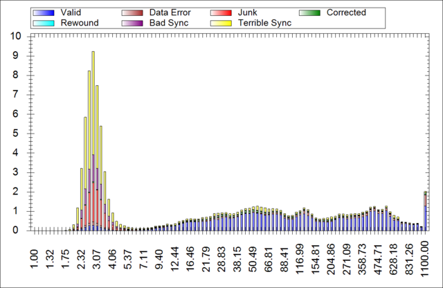
| − | [[File: | + | [[File:AvMap-Signal_Strength_Distribution.png|center|thumb|640px|Distribution of received signal strength]] |
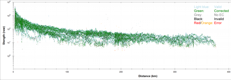
| − | [[File: | + | [[File:AvMap-Strength-Distance-Annotated.png|center|thumb|800px|Frame signal strength vs. transmitter (airframe) distance]] |
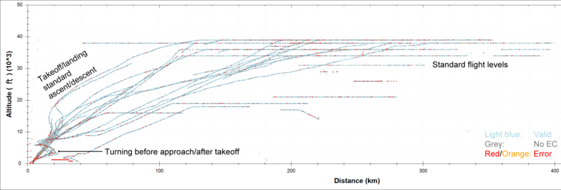
| − | == | + | [[File:AvMap-Strength-Altitude-Annotated.png|center|thumb|800px|Frame signal strength vs. transmitter (airframe) altitude]] |
| + | |||
| + | [[File:AvMap-Altitude-Distance-Annotated.png|center|thumb|800px|Airframe altitude vs. distance]] | ||
| + | |||
| + | == Selected screenshots == | ||
| + | |||
| + | === Aviation Mapper Desktop Tracking App === | ||
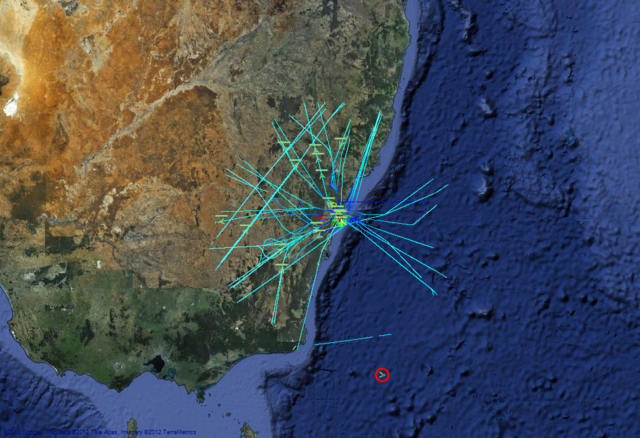
| − | + | [[File:AvMap_514km.png|centre|thumb|640px|Distance record! 514km]] | |
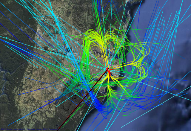
| − | [[File: | + | [[File:AvMap_TrailsBuildUp.png|centre|thumb|640px|Build-up of trails showing different runway configurations throughout the day]] |
| − | + | === 3D Google Earth Front-end === | |
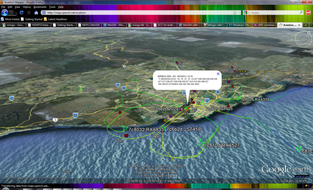
| − | [[File: | + | [[File:AvMap_GE_AngleToYSSY.PNG|centre|thumb|640px|Looking at Sydney airport from side-on, you can see the approach path of planes coming in to land on the active parallel runways]] |
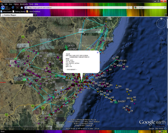
| − | + | [[File:AvMap_GE_ACARSBuildUp.png|centre|thumb|640px|ACARS messages are shown at the circular markers (one is shown in the balloon). Quite a few are sent over the course of a few hours.]] | |
| − | + | == Decoder == | |
| − | + | [[File:ModeS_DecodedBits.png|800px|thumb|center|Scope of Mode S short frame with (red) binary decode overlaid]] | |
| + | |||
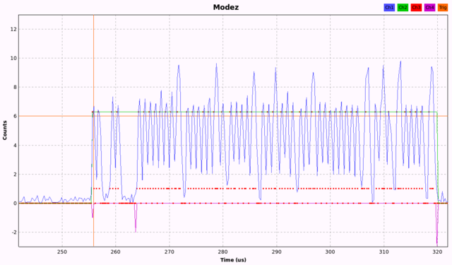
| + | [[File:Modez_Scope.png|640px|thumb|center|Drawing on Eric Cottrell's original decoder, this is the Modez-enhanced scope view with preamble, reference level and data-start/end markers]] | ||
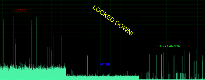
| − | + | [[File:Modez_Noise_Floor.png|800px|thumb|center|Evolution of the decoder showing improved noise floor]] | |
| − | + | == Raw Samples == | |
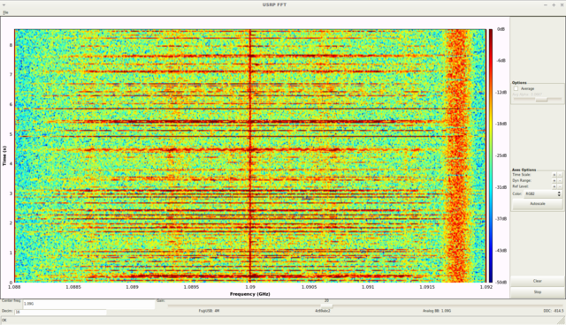
| − | + | [[File:ModeS_with_GSM.png|640px|thumb|center|4MHz chunk visualised in GNU Radio (notice the nearby GSM channel intermod on the right-hand side)]] | |
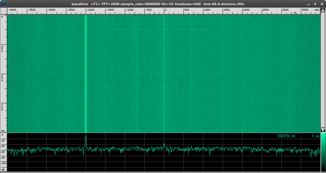
| − | [[File:ModeS_Baudline.png|640px]] | + | [[File:ModeS_Baudline.png|640px|thumb|center|8MHz chunk visualised in Baudline]] |
== Inspiration == | == Inspiration == | ||
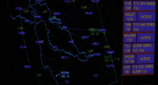
| − | + | [[File:Sneakers_Radar.jpg|640px|thumb|center|Accessing SFO RADAR using the magic code-breaking box in the classic film Sneakers]] | |
| − | |||
| − | |||
{{RF}} | {{RF}} | ||
Latest revision as of 13:51, 3 May 2012
Contents
[hide]Summary
Modez/Aviation Mapper is now running live - please try the web app!
The full write-up with:
- screenshots
- demonstration videos
- experimental results
- comparisons to other hardware
- overseas tests, etc
can be found on the main page.
Statistics
Selected screenshots
Aviation Mapper Desktop Tracking App
3D Google Earth Front-end
Decoder
Raw Samples
Inspiration
| ||||||||||||||||||||||||||||||||||||||||||||||||||||||||||||||||
